Maribyrnong City Council
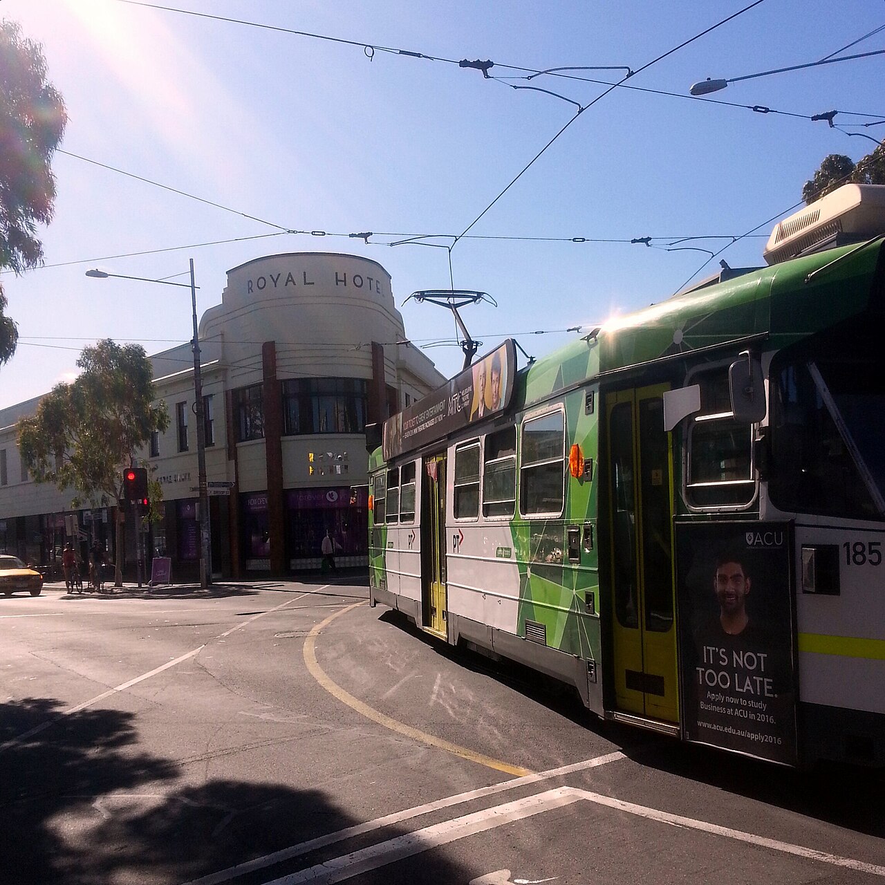
The City of Maribyrnong is the inner-west council that takes in Footscray, West Footscray and Tottenham, along with a short list of other localities. Footscray station is on the Werribee line and the Sunbury line. Melbourne Airport Rail stage 1 starts at West Footscray. The cancelled East West Link was a state proposal through this part of the west. The photograph is the Royal Hotel corner in Footscray, and the tram advertisement dates the picture to 2016.
At a glance
Reviewed 2026-11-01.
The council’s community profile puts the land area at 31.21 square kilometres. The same profile gives an estimated resident population of 94,672 for 2025, a later figure than the Census count below. The state’s council profile, updated 7 April 2026, lists the 2024/25 annual report and the 2025/26 budget as the current documents (Know Your Council).
What is changing
Two changes land in this municipality, and neither is a council project. Melbourne Airport Rail stage 1 is a state rail project starting at West Footscray, including a new Tottenham station. It does not add a train to the airport. Amendment GC270, in operation on 31 March 2026, applies train and tram activity-centre controls, including the height schedule at West Footscray. The metres, and which of them is discretionary, are on the suburb page.
Municipality map
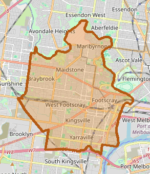
The Maribyrnong River is the eastern and northern boundary of the municipality.
Suburbs and localities
Suburbs in this directory
Suburbs: Footscray, Tottenham, West Footscray
The state’s list of the municipality’s localities: Braybrook, Footscray, Kingsville, Maidstone, Maribyrnong, Seddon, Tottenham, West Footscray and Yarraville.
Population and housing
| People usually resident | 85,209 |
| Median age | 35 |
| Private dwellings | 40,427 |
| People per household | 2.4 |
| Median weekly household income | $1,998 |
These figures are for the City of Maribyrnong, the local government area, not for Footscray or West Footscray. On the same 2021 release the Victorian median age was 38. The state’s council profile says around 40 per cent of residents were born overseas. The 2025 estimate of 94,672 is not this census count.
Infrastructure and transport
Passenger rail through the municipality is the Werribee line and the Sunbury line. Melbourne Airport Rail stage 1 is a state project on the Sunbury corridor, from West Footscray toward Albion, which is outside this council. East West Link was a state proposal. It was cancelled. It was never a council project, and the rail works now under way are not a revival of it.
Lines in this directory: Sunbury Line, Werribee Line
Projects in this directory: East West Link, Melbourne Airport Rail
Planning and precincts
Amendment GC270 came into operation on 31 March 2026. In this municipality it includes Schedule 2 to the Built Form Overlay over the activity-centre core around West Footscray station. The schedule’s maximum heights are 21, 27 and 34 metres, each discretionary. The control is on the land around the station. It does not rebuild the station, and a height the schedule allows is not a permit already granted. The account of the schedule map is on the West Footscray page. The 2026 explainer ranks that station as one of 60 centres. The account of the 60 centres is the list of centres that explainer names.
Council services and official resources
The council’s site is maribyrnong.vic.gov.au. Customer service is at Footscray Library, 56 Paisley Street, Footscray, phone 03 9688 0200.
History and governance context
The City of Maribyrnong was formed on 15 December 1994, from parts of the City of Sunshine and the City of Footscray. South Kingsville, until then part of Footscray, went to the City of Hobsons Bay instead. The municipality took its name from the river that bounds it. Those dates are from the Wikipedia article on the council.
Recent verified changes
- 31 March 2026. Amendment GC270 came into operation, including the West Footscray activity-centre schedule.
- 21 October 2026. Big Build named a preferred bidder for the Sunshine station package on Melbourne Airport Rail. The corridor that package sits in starts at West Footscray, in this municipality. The announcement is a state procurement step. It is not a council project, and it is not a train to the airport.
Sources and related entities
- 2021 Census QuickStats: Maribyrnong (LGA24330), Australian Bureau of Statistics. People, median age, dwellings, people per household, and median weekly household income. The Victorian median age on that page is 38. The geography is the local government area.
- Know Your Council: Maribyrnong City Council, Victorian Government, updated 7 April 2026. Locality list, customer service address and phone, the current annual report and budget, and the statement that around 40 per cent of residents were born overseas.
- About the profile areas, City of Maribyrnong community profile. Land area of 31.21 square kilometres, and the 2025 estimated resident population of 94,672.
- Amendment GC270, Maribyrnong Planning Scheme, Department of Transport and Planning. In operation on 31 March 2026.
- Schedule 2 to Clause 43.06, Built Form Overlay, Maribyrnong Planning Scheme. Discretionary maximums of 21, 27 and 34 metres.
- Preferred bidder named for Melbourne Airport Rail, Victoria’s Big Build, 21 October 2026.
- City of Maribyrnong, Wikipedia. Formed on 15 December 1994, the transfer of South Kingsville, and the river as the eastern and northern boundary.
- Photograph: Barkly, Nicholson, Hopkins and Droop Streets, Footscray, Djackmanson, CC BY-SA 4.0, via Wikimedia Commons.
- Map: OpenStreetMap contributors, retrieved 1 November 2026. Municipal boundary, not a survey plan.