City of Wyndham
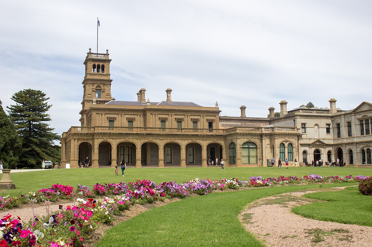
The City of Wyndham is a municipality on Melbourne’s south-western edge. It takes in new residential suburbs, industrial land, and farmland that is still in production. Werribee is one locality in it, at the end of the Werribee line, and the photograph is Werribee Park, in that locality. The council is not the suburb.
At a glance
Reviewed 2026-11-01.
Wyndham covers 542 square kilometres with 27.4 kilometres of coastline. It is one of Victoria’s fastest-growing municipalities, with the population projected to pass 500,000 by 2050 (Know Your Council, updated 4 September 2026). The council’s published Annual Plan and Budget is the 2026–27 document. Earlier years remain on the same page.
What is changing
Growth is the municipality’s defining pressure. The 500,000 figure is a projection, not a census count; the 2021 Census measured 292,011 usual residents, in the table below. Transport has not kept the same pace. The metropolitan line still ends at Werribee, and the growth suburbs beyond the station rely on buses and the regional network through Wyndham Vale. The extension past Werribee was never built. It is one recorded project, not the transport system the municipality has. The comparison with the rail package being built closer to the city is the west is changing faster than the old infrastructure.
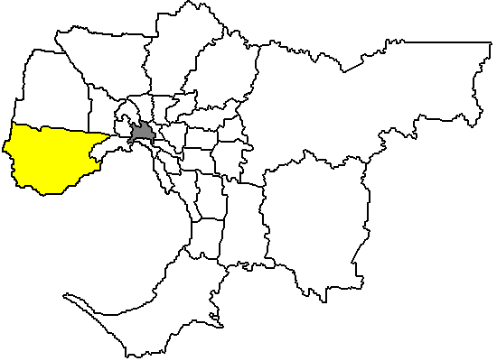
Municipality map
Suburbs and localities
Suburbs in this directory
Suburbs: Werribee
The state’s list of the municipality’s localities: Cocoroc, Eynesbury, Hoppers Crossing, Laverton, Laverton North, Laverton RAAF, Little River, Mambourin, Mount Cottrell, Point Cook, Quandong, Tarneit, Truganina, Werribee, Werribee South, Williams Landing and Wyndham Vale.
Population and housing
| People usually resident | 292,011 |
| Median age | 32 |
| Private dwellings | 100,326 |
| People per household | 3.1 |
| Median weekly household income | $2,023 |
These figures are for the City of Wyndham, the local government area, not for the suburb of Werribee. On the same 2021 release the Victorian median age was 38.
Infrastructure and transport
Passenger rail in the municipality is the metropolitan line, which still ends at Werribee, and regional trains through Wyndham Vale. Geelong’s regional trains were moved off the Werribee corridor in 2015, when Regional Rail Link opened. Laverton North and Truganina are the municipality’s industrial hubs for manufacturing and logistics, and the freight task that goes with them uses the same corridor.
The links below are the line and the never-built extension. They are the projects this directory records. They are not a list of every road, bus or growth-area project in the municipality, and a state rail project is not a council project. The council’s own capital works sit in its Annual Plan and Budget.
Lines in this directory: Werribee Line
Projects in this directory: Werribee line extension
Planning and precincts
Clause 02.03-1 of the Wyndham Planning Scheme names Werribee City Centre as the principal activity centre. The same clause lists other centres, including Werribee Plaza, Williams Landing, Point Cook and Hoppers Crossing, and planned centres in the growth areas, among them Tarneit, Truganina and East Werribee. It describes Werribee Plaza as the largest retail centre in the municipality, with 70,000 square metres of leasable floor space, and gives Williams Landing a capacity of 6,500 residents beside the station. Those are planning figures, not a census count and not a count of homes already built.
Precinct structure plans are the instrument the clause names for Wyndham North, Wyndham West, and the East Werribee Employment Precinct. Two green wedges, Werribee South and Western Plains South, are to be protected from urban intrusion. A centre, a capacity figure, or a precinct structure plan is a framework. It is not a planning permit, and it is not a funded project.
Wyndham and Greater Geelong signed a five-year memorandum of understanding in 2025 that names the Avalon Corridor Strategy, covering land between Lara and Werribee, as a shared priority. Werribee’s suburb page carries the precinct detail for the covered suburb.
Council services and official resources
The council’s site is wyndham.vic.gov.au; its office is at 45 Princes Highway, Werribee, phone 1300 023 411. The current Annual Plan and Budget is the 2026–27 document. The planning scheme is published through the Department of Transport and Planning. Werribee Park, the Mansion, the State Rose Garden and Werribee Zoo are the major attractions in the municipality.
History and governance context
The Wadawurrung and Bunurong peoples were the area’s first occupants. The municipality’s farmland still grows most of Victoria’s cauliflower, broccoli and lettuce — the working rural remnant of a council area now organised around new suburbs. Werribee Park, in the photograph, is from the earlier pastoral era.
Recent verified changes
- September 2025. Wyndham and Greater Geelong councils signed a five-year memorandum of understanding naming the Avalon Corridor Strategy a priority.
- October 2026. The council joined Greater Geelong in writing to the Public Transport Minister proposing a trial of direct Werribee-Geelong passenger trains, using tracks that still carry freight.
Sources and related entities
- 2021 Census QuickStats: Wyndham (LGA27260), Australian Bureau of Statistics. People, median age, dwellings, people per household, and median weekly household income. The Victorian median age on that page is 38. The geography is the local government area.
- Know Your Council: Wyndham City Council, Victorian Government, updated 4 September 2026. Area, coastline, locality list, industrial hubs, Traditional Owners, and the 2050 population projection.
- Wyndham City’s Annual Plans and Budgets, Wyndham City Council. The published list leads with the 2026–27 Annual Plan and Budget. Checked 27 October 2026.
- Clause 02.03, Strategic direction, Wyndham Planning Scheme, clause 02.03-1 as dated 10 February 2022 (amendment C258wynd), in the council’s December 2025 gazetted copy. Principal activity centre, the other named centres and their floor-space and capacity figures, precinct structure plan areas, and the two green wedges.
- Better connecting Wyndham and Geelong, Geelong Independent, 11 September 2025. The 2015 severing of direct Werribee-Geelong services, the councils’ memorandum of understanding, and the Avalon Corridor Strategy.
- Photograph: Werribee Park mansion and gardens, Philip Mallis, CC BY-SA 2.0, via Wikimedia Commons.
- Map: Map of Melbourne, LGA of Wyndham City highlighted, Bill da Flute, public domain, via Wikimedia Commons.