Melbourne's 60 Activity Centres: Where Higher-Density Housing Is Really Going
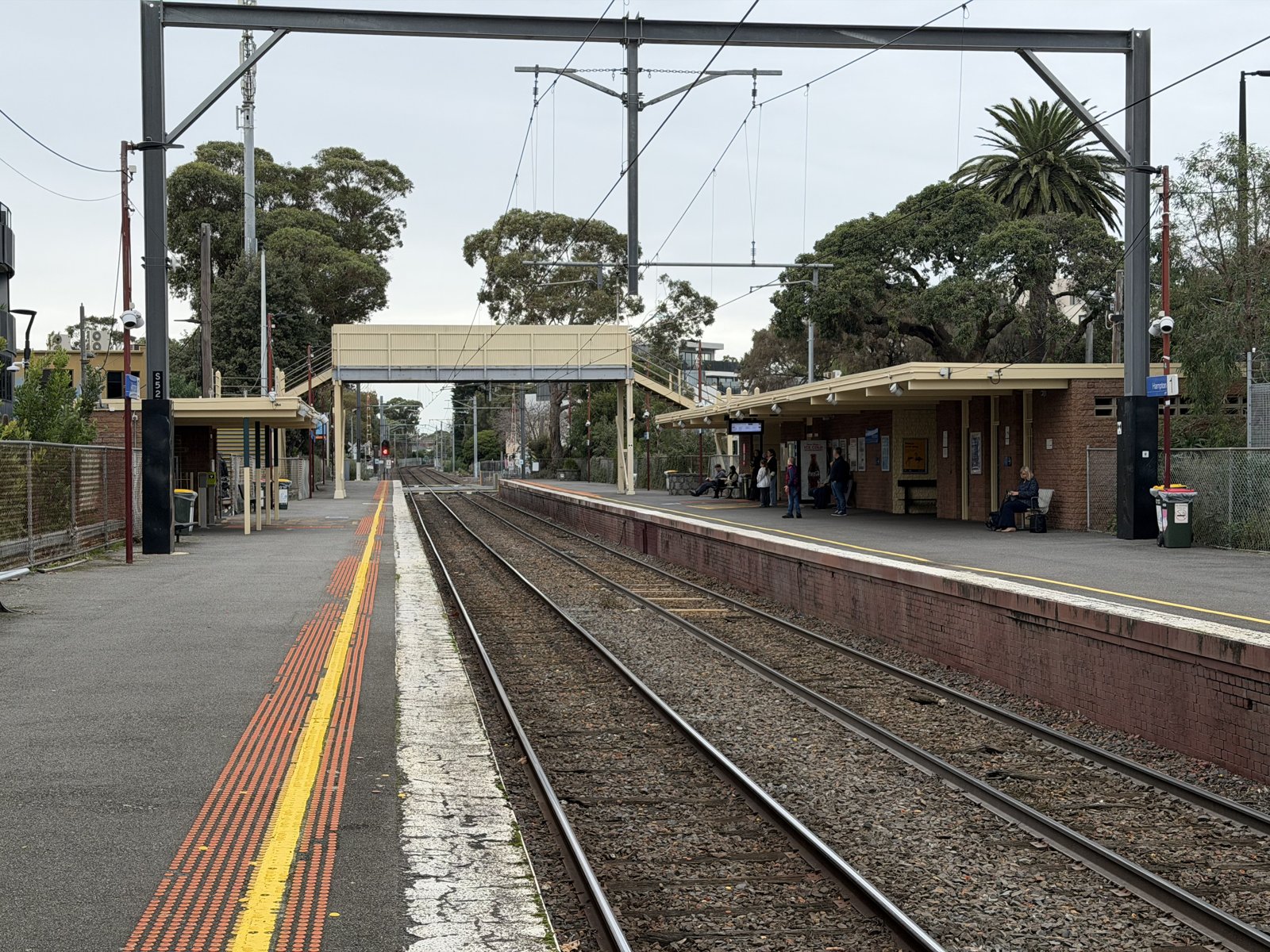
The Department of Transport and Planning has finalised planning controls for 60 train and tram activity centres. Its program page says those controls support the delivery of more than 300,000 homes close to public transport. That figure is the capacity the controls are written to allow, across the whole program. The photograph is Hampton station on 13 June 2026, looking south from platform 2. The department’s 2026 program explainer lists Hampton as a stage 1 centre. The picture is the station the control is drawn around.
How the 60 are counted
The program page, checked on 1 November 2026, says that by 2051 metropolitan Melbourne is expected to require around 1.8 million homes. The same page says the activity-centre controls support the delivery of more than 300,000 homes. The first number is a metropolitan requirement. The second is enabled capacity. The program timeline uses a third figure: around 2.24 million additional homes across Melbourne and Victoria’s regional cities and towns over the next 30 years. That count includes regional Victoria.
The timeline page says the program began in 2024 with a pilot of 10 major centres, intended to support around 60,000 additional homes. In 2025 it expanded to a further 50 train and tram zones: stage 1, counted as 25 centres; stage 2, counted as 23; and two further centres in inner Melbourne, in the City of Melbourne and the City of Yarra. Ten plus 50 is 60. The pilot’s 60,000 sits inside the timeline’s account of that first group. The page also says planning controls are now in the planning scheme for each of the 60 centres, and that infrastructure contributions plans are proposed to be gazetted in stages across 59 centres. A proposed contributions plan is a later step than a control already in a scheme. The program page says the program does not involve compulsory acquisition, and that existing heritage protections continue to apply.
What the height words mean
The explainer’s diagram describes the core, under a Built Form Overlay or an Activity Centre Zone, as 6 to 16 storeys, higher on some sites subject to further urban design testing. It describes the inner catchment as a 4-storey maximum, or 6 storeys on a site over 1,000 square metres with a 20-metre frontage. The outer catchment is a 3-storey maximum, or 4 storeys on a site of that size and frontage. Those sentences are the program’s description. The control for a centre is the schedule in its scheme.
The same explainer ranks centres from category 1 to category 4, and says category 4 is suitable for the most growth. Its appendix says the discretionary maxima run from 21 metres, which it calls six storeys, for a category 1 centre, up to 16 storeys or higher on some sites for a category 4 centre, subject to further urban design testing. It converts storeys from floor heights of 4.5 metres on a commercial ground floor, 4 metres on a commercial upper floor, and 3.2 metres on a residential floor. The category is the ranking. The metres in a schedule are the control.
West Footscray is the centre where this directory has read the schedule. The explainer puts West Footscray station in stage 1, category 2. Amendment GC270 came into operation in the Maribyrnong scheme on 31 March 2026, and the schedule sets discretionary maxima of 21, 27 and 34 metres in that core. The department’s own West Footscray page, updated on 2 October 2026, still describes parts of the same core as up to 12 storeys. The metres, and the difference, are set out in what the West Footscray rules allow. Tottenham station, which the explainer lists as Tottenham Station (Braybrook), is the other stage 1 centre with a page here. Both are in Maribyrnong, on the Sunbury line. Places where station-side growth is already standing, such as Box Hill, are a separate account: why Melbourne keeps building around stations.
The centres the explainer names
Table 2 of the 2026 explainer is the housing growth framework for the stage 1 and stage 2 centres. The category columns name 24 centres under stage 1 and 20 under stage 2. The timeline page counts those stages as 25 and 23. The table’s notes name six further centres that the columns leave unranked: Heidelberg, Elsternwick and Carnegie, whose core heights the explainer says come from earlier council work, and Yarraman, Riversdale and Willison, which it says have no core and therefore no category. Twenty-four, plus 20, plus those six, is 50, the size of the expansion. The explainer does not mark which of those names are the timeline’s two inner Melbourne centres, or which column is short of the timeline’s stage count. The pilot of 10 is a separate group, and this explainer does not name it. The department’s activity-centre finder is the map of the program. An asterisk is the explainer’s mark for a neighbourhood centre in Plan for Victoria.
| Centre | Stage | Category |
|---|---|---|
| Hampton Station | 1 | 3 |
| Sandringham Station | 1 | 3 |
| Oakleigh Station | 1 | 3 |
| Glenferrie Station | 1 | 3 |
| Hawthorn Station | 1 | 3 |
| Auburn Station | 1 | 3 |
| Kew Junction | 1 | 3 |
| Brunswick Train and Tram Zone | 1 | 3 |
| Coburg Station | 1 | 3 |
| North Brighton Station | 1 | 2 |
| Middle Brighton Station | 1 | 2 |
| High Street (Thornbury) | 1 | 2 |
| Murrumbeena Station | 1 | 2 |
| Hughesdale Station | 1 | 2 |
| West Footscray Station | 1 | 2 |
| Tottenham Station (Braybrook) | 1 | 2 |
| Tooronga Station | 1 | 2 |
| Gardiner Station | 1 | 2 |
| Glen Iris Station | 1 | 2 |
| Darling Station | 1 | 2 |
| Holmesglen Station | 1 | 2 |
| St Georges Road (Thornbury) | 1 | 1 |
| East Malvern Station | 1 | 1 |
| Middle Footscray Station (Seddon)* | 1 | 1 |
| South Yarra Station | 2 | 4 |
| Caulfield Station | 2 | 4 |
| Dandenong Station | 2 | 4 |
| Prahran Station | 2 | 3 |
| Windsor Station | 2 | 3 |
| Malvern Station | 2 | 3 |
| Glenhuntly Station | 2 | 3 |
| Blackburn Station | 2 | 3 |
| Springvale Station | 2 | 3 |
| Hawksburn Station | 2 | 2 |
| Toorak Village* | 2 | 2 |
| Armadale Station | 2 | 2 |
| Bentleigh Station* | 2 | 2 |
| Ormond Station | 2 | 2 |
| Nunawading Station | 2 | 2 |
| Mitcham Station | 2 | 2 |
| Mentone Station | 2 | 2 |
| Noble Park Station | 2 | 2 |
| Ashburton Station* | 2 | 2 |
| Toorak Station | 2 | 1 |
The explainer says some of these centres use existing council controls together with the category, so the category applies only to some of their area: Toorak, South Yarra, Prahran, Windsor, Dandenong, Caulfield, Glenhuntly and Bentleigh. It also says some strategic redevelopment sites have heights above their category, and it does not name those sites. A centre’s core height, in metres, is in its own schedule. West Footscray is the schedule this directory has read.
References
- Train and Tram Zone Activity Centres Program, Department of Transport and Planning, checked 1 November 2026. Sixty centres, around 1.8 million homes required in metropolitan Melbourne by 2051, and controls that support delivery of more than 300,000 homes. The page says the program does not involve compulsory acquisition, and that existing heritage protections continue.
- Program timeline and milestones, Department of Transport and Planning, checked 1 November 2026. The pilot of 10 and around 60,000 homes, the expansion to 50 centres as stage 1 (25), stage 2 (23) and two inner Melbourne centres, more than 300,000 additional homes by 2051, around 2.24 million additional homes including regional Victoria, controls in each scheme, and infrastructure contributions plans proposed across 59 centres.
- Train and Tram Zone Activity Centres Program, program explainer, Department of Transport and Planning, 2026. Table 2, the core and catchment storey bands, the category 1 to category 4 height range, and the floor heights used to convert storeys.
- Amendment GC270, Maribyrnong Planning Scheme, in operation on 31 March 2026. The West Footscray schedule is set out in what the new planning rules allow.
- Find an activity centre, Department of Transport and Planning. The department’s map of the program.
- Photograph: Hampton railway station, platform 2, 13 June 2026, PEPSI697, CC BY-SA 4.0, via Wikimedia Commons.