Doncaster
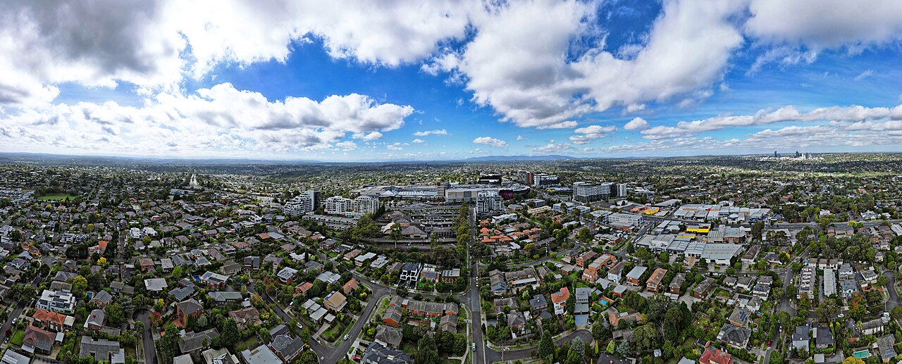
Doncaster is a suburb in Melbourne’s east, in Manningham City Council. It has no railway station. The Doncaster line was proposed from the 1890s, included in the 1969 Melbourne Transportation Plan, and never built. Bulleen, the next suburb toward the city, is on the same corridor. The photograph looks across Doncaster Hill in April 2023, the apartments above the houses, toward the central city.
At a glance
Reviewed 2026-11-01.
Council: Manningham City Council
There is no operating railway in the suburb. The Doncaster line is the railway that was not built. The council’s office is on Doncaster Road.
What is changing
No railway is under construction here. The road project on this corridor is North East Link, a tunnel between the M80 and the Eastern Freeway through Watsonia and Bulleen. The Auditor-General’s February 2025 report says the main tunnel works are under way. That tunnel is not a train, and it is not in Doncaster.
Location and boundaries
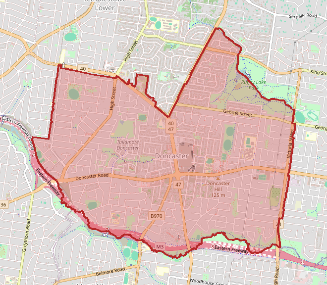
Wikipedia places the suburb 18 km east of the central city, on about 8.9 square kilometres, around a hill of about 120 metres. Those figures are not Census counts. The Census figures below use the ABS suburb Doncaster (SAL20771), a different dataset from the outline above.
Transport and access
Lines that reach this suburb: Doncaster Line
Doncaster Road is the street through the suburb, and the Eastern Freeway runs along its southern edge. Neither is a railway. The Doncaster line would have run along the freeway median for most of its length, serving Bulleen and Doncaster among other suburbs. The tracks were not laid.
Infrastructure projects
The Doncaster line is the unbuilt project. No cost or year is recorded for it. North East Link is a separate road, in the next suburb toward the city, and the February 2025 audit describes its main tunnel works as under way.
Planning and development
Wikipedia describes a centre along the top of Doncaster Hill, with Westfield Doncaster and the apartments around it, and low-density housing across the rest of the suburb. That is a description of what is built.
Population and housing
The Australian Bureau of Statistics counted Doncaster, the suburb, in the 2021 Census. These figures are not the City of Manningham. The median age was 40, against 38 for Victoria, and the average household was 2.4 people, against 2.5 for Victoria.
| People | 25,020 | | Median age | 40 | | Private dwellings | 11,731 | | Average people per household | 2.4 | | Median weekly household income | $1,592 |
History and local context
In 1841 Frederic Unwin bought 5,120 acres from the Crown, including most of the present suburb, under the Special Survey regulations. The area was settled in the 1860s and 1870s, largely by German orchardists. Their settlement was named Waldau. The name Doncaster replaced it. Those dates are from Wikipedia’s account of the suburb.
Recent verified changes
- February 2025. The Auditor-General reported that the main tunnel works on North East Link were under way. The tunnel is in Bulleen. Doncaster still has no railway.
Practical questions
Is there a train station?
No. The Doncaster line was never built. Buses and the Eastern Freeway are the transport on this corridor.
Is North East Link the railway?
No. It is a road tunnel through Watsonia and Bulleen. The Auditor-General’s February 2025 report treats the tunnel works as under way, and treats the Doncaster line as a different, unbuilt project.
Are the Census figures for Manningham?
The table is the suburb, SAL20771. The municipality’s count is on the council page.
Sources and related places
- Doncaster, 2021 Census QuickStats, Australian Bureau of Statistics. Suburb and Localities geography. The Victorian comparisons are on the same page.
- Doncaster, Wikipedia. The distance, the area, the hill, the 1841 survey, and the orchard settlement.
- Doncaster railway line, Wikipedia. The proposal from 1890, the 1969 planning, and the freeway-median route.
- Victorian Auditor-General’s Office, February 2025, as cited on the North East Link page. The main tunnel works were under way. The report treats the Doncaster line as a different, unbuilt project.
- Photograph: Bob Tan, File:Aerial panorama of the elevation of Doncaster Hill and its surrounds. April 2023.jpg, Wikimedia Commons, CC BY 4.0.
- Locality outline: OpenStreetMap relation 2386805. Map data © OpenStreetMap contributors, retrieved 1 November 2026.